
In development
Parent-child grading families
Grading families where child grading objects follow a parent recipe.
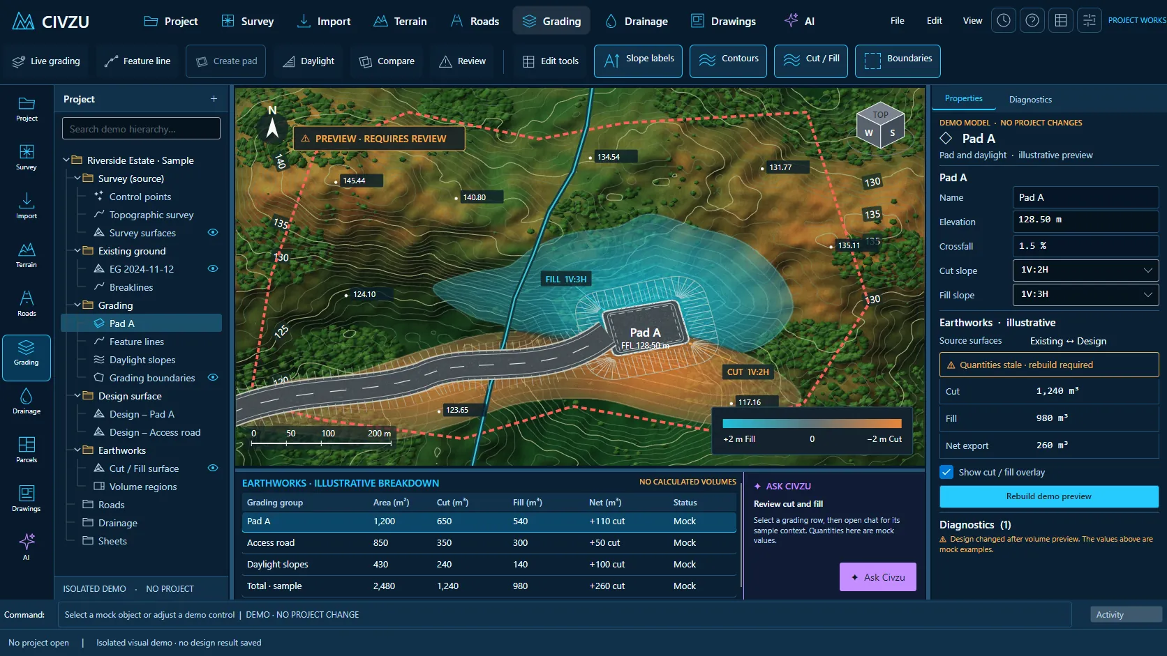
Grade pads, slopes and retaining walls against the terrain, then measure cut and fill, mass haul, topsoil and subgrade for every alternative. Quantities carry their method and assumptions with them.
 APP CAPTURE · ILLUSTRATIVE PROJECT
Your engineers work in the desktop workbench; your agent reaches the same project through typed local tools. Items tagged In development are being built now.
Grading families where child grading objects follow a parent recipe.
Grade from feature lines with an offset and grade rule.
Grade from a feature line out to daylight on a selected surface.
Apply cut or fill side slopes to grading.
Benched and stepped side-slope grading.
Grade pond banks and basins inward to a base level.
Create building pads relative to existing terrain.
Generate kerb and channel features within site grading.
Grade footways, verges and site edges.
Edit feature-line vertex levels.
Set fixed slopes and grades and interpolate levels along feature lines.
Join and split grading objects.
Offset feature lines that stay linked to their source and merge feature lines.
Downhill slope arrows with percentage and 1:n labels on cut/fill views and grading sheets.
Grading reports conflicts and missing targets instead of producing a wrong result.
Retaining walls from alignment and profile geometry, including curved and parallel walls.
Continuous wall assemblies with construction and expansion joints on curved and parallel walls.
Material quantities for retaining-wall stems and footings.
Extrude parametric profiles along a path to model linear features.
Plant properties driven from your own data tables.
Landscape styles and object libraries.
Points and labels showing two elevations, such as top and bottom levels.
Existing-versus-design cut and fill volumes.
Stripping depths and topsoil quantities.
Subgrade depths set per site region.
Layered soil and material quantities.
Ground-versus-design cut and fill areas at sections.
Volumes by the average-end-area method.
Volumes by TIN-to-TIN integration.
Apply your declared shrink, swell and bulking factors to volumes.
Cut and fill maps classified into colour bands by region.
Trim overlapping quantities within each design tool.
Landscape planting quantities by species and density.
Export quantity reports to XLSX workbooks.
Compare drainage and mass-haul quantities between revisions with an audit trail.
“Grade Pad A at 128.5 m with 1 in 2 cut and 1 in 3 fill and daylight it to existing ground.”
“Compare cut, fill and haul for the two platform levels and recommend one.”
“Export the topsoil strip and subgrade quantities by area to a workbook.”
Reserve your early-access seat. We confirm your MCP client, seat count and commercial details before access opens.
Reserve your seat ↗