
Point import with column mapping
Import delimited point files with your own column mapping in the desktop app.
Bring survey into a project foundation you can trust. Import and validate points, run COGO and traverse studies, adjust observations, georeference the site and keep every source change traceable from the first point.
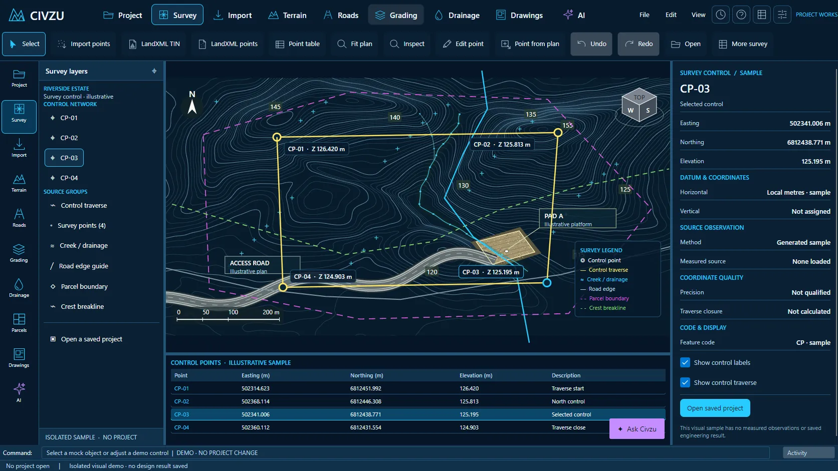 APP CAPTURE · ILLUSTRATIVE PROJECT
Your engineers work in the desktop workbench; your agent reaches the same project through typed local tools. Items tagged In development are being built now.
Import delimited point files with your own column mapping in the desktop app.
Project description-key tables translate survey field codes into layers, symbols and descriptions.
Create survey points by typing coordinates, with on-screen creation in the desktop app.
Convert CAD text and level labels into survey points in one checked batch.
Create points at the vertices of existing lines.
Place points along an alignment at set chainage intervals and offsets.
See which point numbers are free and get warned about numbering conflicts.
Renumber, reorder and pack point numbers in a single batch.
Static and rule-based point groups with a saved display order.
Browse points in a table and edit name, code and coordinates.
Move, rotate and uniformly scale selected points in plan.
Raise or lower point elevations independently of plan position.
Round displayed elevations without altering the original survey observations.
Report distance, bearing and slope between any two points.
Measure three-point angles and arcs.
Locate a new point from measured distances to known points.
Average point positions and estimate centres from selected points.
Compare design points with as-built survey points and report the differences.
Search and replace point descriptions using code rules.
Convert survey figures into breaklines, with results marked stale when the source changes.
Design points take their levels from surfaces and profiles and stay linked to them.
Transform point coordinates in batches between declared coordinate systems.
Compare point elevations against two surfaces in the desktop app and over MCP.
Synchronise survey sources and delete or restore points while original observations stay retained.
Export and import point groups and display settings between projects.
Import and export description-key tables in Civzu's own format.
Store the project's horizontal coordinate reference system.
Record vertical datum, height type and units.
Map local drawing coordinates to world coordinates.
Georeference from control points with residual reports.
Preview a coordinate system before selecting it.
Work explicitly in a local engineering coordinate system.
Validate units and axis order of coordinate data.
Place rasters using world files.
Reproject data and get told when a required grid is missing.
Record the provenance of coordinates and transforms.
Record source accuracy, resolution and capture date.
Export coordinate settings with CSV and WKT definitions.
“Import this week’s survey, validate it against control and tell me which points look wrong.”
“Run a traverse study from CP-01 to CP-04 and report the misclosure.”
“Compare the as-built points with the design surface and list anything outside 25 mm.”
Reserve your early-access seat. We confirm your MCP client, seat count and commercial details before access opens.
Reserve your seat ↗