
TIN surfaces from points
Build triangulated terrain surfaces from survey points.
Build constrained ground models from survey points, breaklines, point clouds and elevation rasters, then query, compare, repair and inspect them in 2D and 3D. Imagery and online elevation sources sit beside the model with their attribution intact.
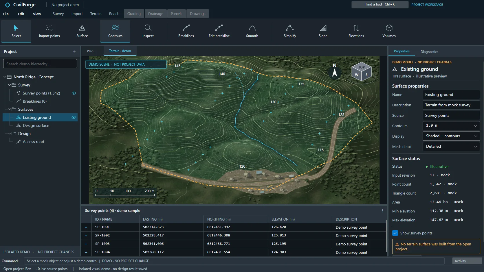 APP CAPTURE · ILLUSTRATIVE PROJECT
Your engineers work in the desktop workbench; your agent reaches the same project through typed local tools. Items tagged In development are being built now.
Build triangulated terrain surfaces from survey points.
Constrain surfaces with breaklines and boundaries; crossings without levels are refused, not guessed.
Cut holes in surfaces or hide areas from display.
Generate contours at chosen major and minor intervals.
Smooth contours for display within a stated deviation, while exports stay exact.
Analyse surfaces by elevation, slope and aspect bands.
Sample surface profiles and sections along lines and saved alignments.
Select points above, below or within a distance of a surface.
Combine several surfaces into minimum or maximum composite surfaces.
Compute surface differences and weighted surface arithmetic.
Create offset surfaces and variable-thickness layered sub-surfaces.
Merge surfaces or clip them to a boundary.
Preview terrain repairs while the original survey data is preserved.
Build terrain from DXF 3DFACE, polyface and mesh entities across layers.
Import LAS and LAZ point clouds into terrain with classification and area filters.
Import GeoTIFF elevation rasters as terrain.
Control raster sampling resolution and declared no-data values.
Save and load contour and slope analysis settings files.
Surface edits rebuild dependent contours and results, with cancel, undo and redo.
Each terrain source records its hash and declared accuracy.
Connect to WMS imagery and WCS elevation services through a provider-neutral interface.
Configure your own provider credentials and entitlements.
Define areas of interest as polygons or corridors.
Manage points of interest and collections.
Image, map and hybrid display modes with transparency.
Choose imagery resolution and build mosaics.
Import your own georeferenced images.
Clip images and set transparency.
Bring in elevation data through online source adapters.
Use survey rasters and point clouds as terrain sources.
Preview terrain sampling and import size before downloading.
Browse historical imagery by date.
Compare imagery dates for sites and corridors.
Drape imagery over terrain in 3D, with a CPU fallback.
Overlay CAD context on geographic viewers.
Non-georeferenced locator images are clearly labelled.
Imagery caching follows attribution and licence policy.
Handle unavailable providers and expired access cleanly.
“Build the existing-ground surface from the survey and the kerb breaklines, then report the contours at 0.5 m.”
“Import the LAZ scan, filter to ground and compare it with the survey surface.”
“Where is the site steeper than 1 in 3? Give me the areas and a slope map.”
Reserve your early-access seat. We confirm your MCP client, seat count and commercial details before access opens.
Reserve your seat ↗